


INPUT ACCOUNTABILITY
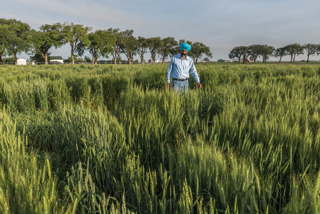
BY IAN DOIG • LEAD PHOTO COURTESY OF NEVIN ROSAASEN
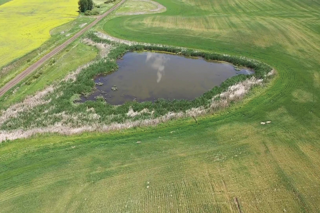
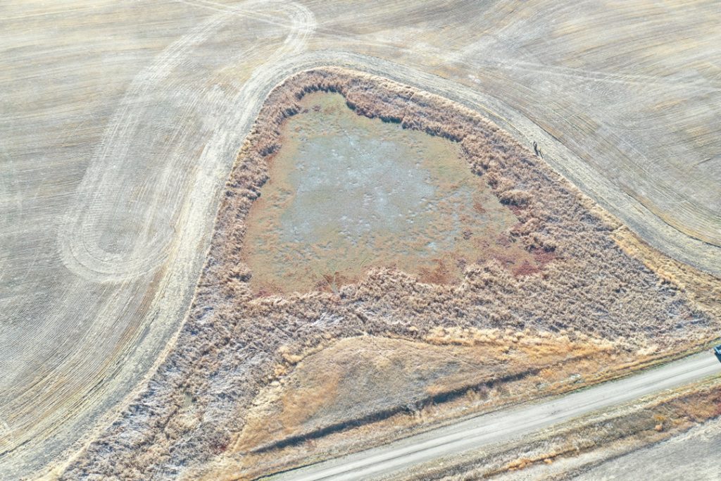
On a bright but chilly day last October, Nevin Rosaasen, Alberta Pulse Growers (APG) sustainability and government relations lead, and Hayley Webster, the commission’s Adaptation Resilience Training project assistant, made their way to a small slough on Hannah Konschuh’s farm near Cluny. Konschuh, a former Alberta Wheat Commission (AWC) director, joined them for the short hike down from an adjacent dirt road to examine this modest, semi-permanent wetland.
It was the fifth and final data collection stop for the first year of a three-year, water stewardship initiative launched by Team Alberta Crops. Funding for the $1.5-million project includes $750,000 provided by Results Driven Agriculture Research, $417,500 of which was secured through the Canadian Agricultural Partnership. The remainder has been contributed by APG, AWC, Alberta Barley, Alberta Canola, Alberta Sugar Beet Growers, Alberta Potato Growers and industry supporters. The project’s 10 wetland sites are located on farms in the southern region of the province and samples are also being taken from 10 tributaries in the Milk River and South Saskatchewan River watersheds.
Konschuh’s wetland had completely dried up over the course of the 2021 summer drought. Surprised by its severity, she said the 2021 harvest was the farm’s worst ever, and its surface water vanished. “Two nearby sloughs usually have mud hens on them, but they’re also dry,” she said.
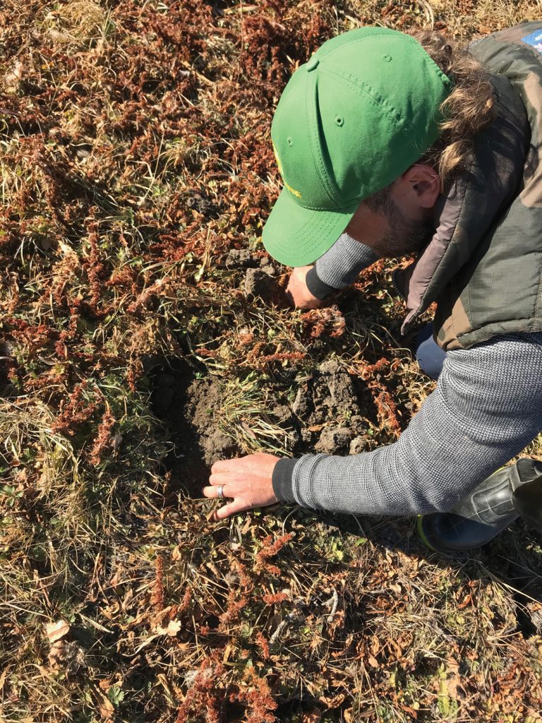
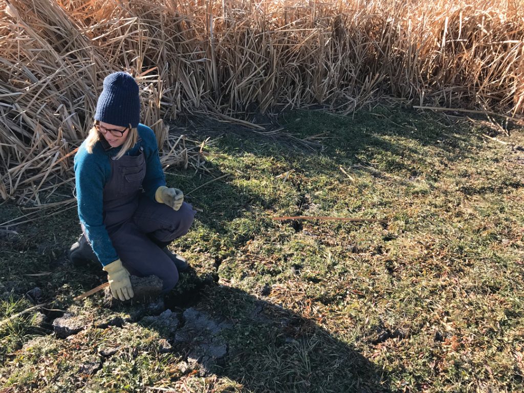
Once he recorded rain gauge readings, Rosaasen launched a drone to capture imagery of the area while Webster carried out a vegetative assessment. She placed two metre sticks in an L shape among the wild plants of the filter strip that ringed the slough. She carefully recorded the types of plants and the extent of ground cover within the area. This particular square metre was thick with cat tails and a variety of wild grasses, sedges and rushes. She stashed a portion of one of the grasses in a container for later identification.
Near a set of moose tracks preserved in the cracked mud, Rosaasen broke open chunks of slough bottom to reveal the roots, grubs and worm tunnels within. He completed a formal insect inventory process in the spring of 2021 at each of the project’s sites. This will form a picture of their insect populations, from parasitic predators to beneficial pollinators.
Though some of the project’s target waterbodies dried up for a portion of the year, they also yielded the water samples central to the project. This sampling was carried out nine times at each site over the course of the year by Millennium EMS Solutions, an environmental consulting company. Monitoring for crop protection product levels will provide the farm sector with scientific data to inform Health Canada’s Pest Management Regulatory Agency (PMRA) decision-making regarding farm chemistry. Data collected may help prevent unnecessary bans of crop protection products by the PMRA, which is a project collaborator.
Chemistry levels measured in year one have not hit PMRA thresholds. These guidelines indicate the maximum allowable levels of individual chemicals for a range of species such as aquatic invertebrates and fish. Allowable limits are measured as acute, one-time exposures at a high level, and chronic, a level of toxicity present over a given period of time. “We haven’t had a single exceedance,” said Rosaasen.
The water bodies being studied are surrounded by strips of vegetation from the minimum-three-metre buffer width required where pesticides are applied, to as much as 30 metres. Others are fenced off for grazing. “We’re trying to establish whether or not these wetlands continue to be healthy ecosystems for all of the critters that use them,” said Rosaasen.
Because farmers have granted access to their private land, the study critically benefits from its pesticide use history. “Having a non-detect of, say, glufosinate—Liberty—means nothing unless we can prove Liberty was sprayed on that [adjacent] canola crop,” said Rosaasen. “And that’s the data the PMRA needs. If we have non-detects for 60 pesticides, they want to know which five or six pesticides may have been used on that field. Farmers provide that pesticide use history and we can then say, ‘yes, this pesticide was applied and it did not show up in the wetland.’”
The scope of the study required the participating lab to develop detection methods for 27 commonly used pesticides. The results of its analyses will be fed into an online data portal where the information will be available to the PMRA. In fact, users will be able to view all of the collected data pertaining to these wetlands. The PMRA will be presented with all of the collected data pertaining to these wetlands. This will include the date and type of products sprayed and the accompanying wind conditions. The species and characteristics of the plants that inhabit the filter strips, as well as insects, birds and other wildlife associated with these areas will also be noted.
Konschuh was keen to volunteer the use of her farm’s wetland acres for the project.
Farmers contribute to environmental stewardship with the ecosystem services they provide, such as no-till practices and the addition of carbon to the soil, she said. “But when it comes to the inputs we’re spraying on our fields, there may be changes in practice we can employ to benefit and protect wetlands so they also continue to provide ecosystem services. If we have the information to do that, we can make better decisions.”
Her main reason for participation is the preservation of chemistry options. In the past, when the PMRA has released a proposed decision on usage, it has been based on modelling that did not necessarily take Prairie conditions and farm practices into account. Stakeholders had 90 days to collect their own risk assessment data and respond. The collection of this data in advance puts the entire regulation process on better footing. “If you’re making decisions off an incomplete data set, that’s not accurate or not applicable to the western Canadian environment; there can be terrible impacts for farmers in terms of the products they have access to,” said Konschuh.
As proof the process works, she cited a two-year wetland study conducted by the Canadian Canola Growers Association and the Canola Council of Canada to assess the impact of neonicotinoid seed treatment. It indicated very low levels of chemistry are present in wetland waters when seeding is carried out right up to the buffer strip. “That data allowed us to retain the use of seed treatments as farmers,” she said.
While the collection of this data is certainly valuable to farmers, Webster said wetlands themselves play a role in carbon sequestration and climate change adaptation that is likewise useful. “No-till is recognized as a way to sequester carbon in farming. If managed properly, wetlands are able to sequester a lot more carbon at a much faster rate.” They also help mitigate flooding by soaking up water and hold onto it in times of drought, she added. “It’s important to understand the good they can do for everyone.”

Comments