


SEARCH AND DESTROY
ROCKY VIEW COUNTY TAKES TO THE SKY TO STOP SPREAD OF
NOXIOUS WEEDS
BY GRIFFIN ELLIOT
Alberta’s Rocky View County is embracing the technological age by using drones to find and identify noxious weeds before they have a chance to contaminate farmers’ fields.
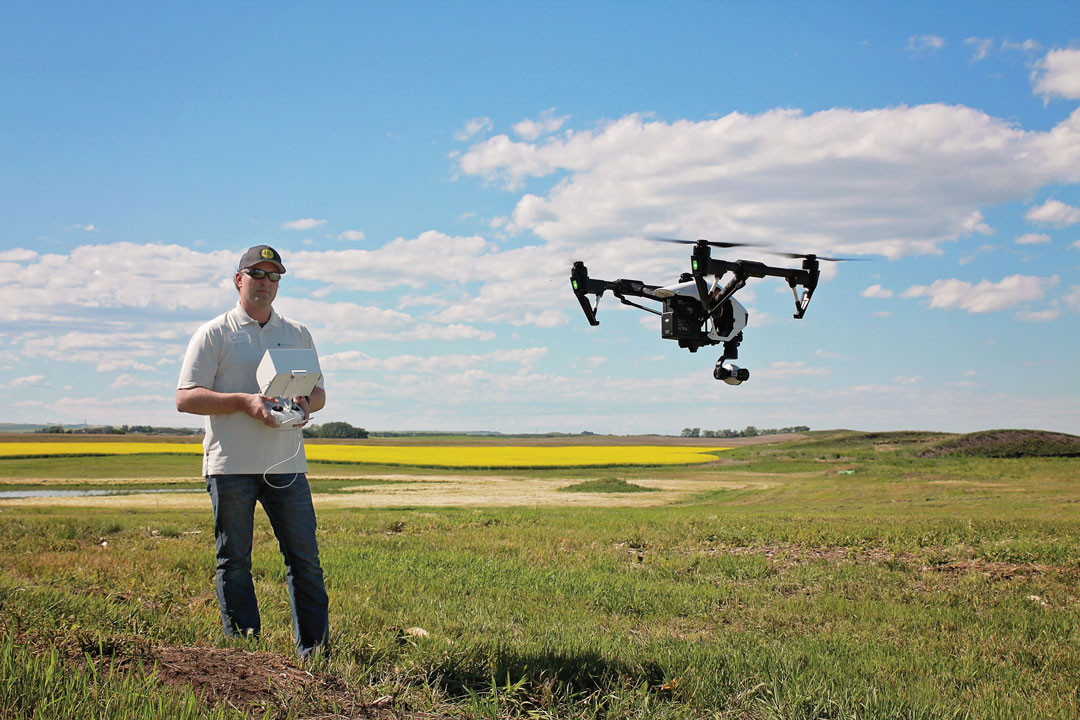
“We’re not even going into farmers’ fields. We’re trying to get to the problem at the stage before it gets to the farm fields,” said Jeff Fleischer, supervisor for the county’s agricultural and environmental services department. “We’re using it on remote areas, adjacent to the rivers or steep terrain, trying to identify the weeds there in smaller, isolated patches, before they spread to become an agricultural issue.”
Fleischer helped usher in the pilot program this year and said it’s been even more successful than the county could have anticipated—making expansion a definite possibility.
“I was a bit skeptical at first,” Fleischer said, “but for our first year into this I do think it was a success and I could see it expanding in the future. And not only in agriculture, there are other departments here in our county that are showing interest.”
Drones are effective tools for the job because, as Fleischer pointed out, many of the problematic areas that need to be surveyed are remote locations that are not easily accessible for a weed inspector on foot. “What the [drone] provides is a tool that makes it a lot easier to have an overview of what’s going on and, basically, to do an inspector’s job,” said Chris Neeser, a weed research scientist from Alberta Agriculture and Forestry.
The county is specifically using the technology to detect weeds that have been labelled as “prohibited noxious” under the Alberta Weed Control Act, such as purple loosestrife, orange hawkweed and leafy spurge.
“You want to catch them as early as possible because they’ll be easier to handle. Once you’ve got a big patch, it’s a much more expensive proposition,” Neeser said. “Prohibited noxious [weeds] especially, you don’t want them to spread at all.”
Once the weeds are identified, the county will help the landowner come up with a control plan.
“The landowner has the duty to control these weeds,” Neeser said. “If it’s a prohibited noxious one, they have to be destroyed, and if it’s a noxious one, they simply have to prevent them from propagating.”
Rocky View County’s pilot drone project was executed on a tight budget, Fleischer said, by investing in “entry-level” drone hardware. “We bought a fairly cost-effective drone,” he said. “Drones range in price from $1,500 all the way to hundreds of thousands. We do see areas where in the future it might be useful to update the camera so that we can do different mapping.”
Overall, the use of drone technology in agriculture is on the rise. As drones have become more affordable and their capabilities have expanded, more and more farmers are trying the technology for themselves. In addition to Rocky View County’s drone pilot project, Fleischer noted that similar programs have been developing simultaneously. “There are private consultants that farmers are using as well to fly over and do field scouting,” he said. “I’m seeing more and more companies start up, and a few other counties using it as well.”


Comments