


SKY HIGH
BY TREVOR BACQUE • PHOTO COURTESY OF PIXABAY
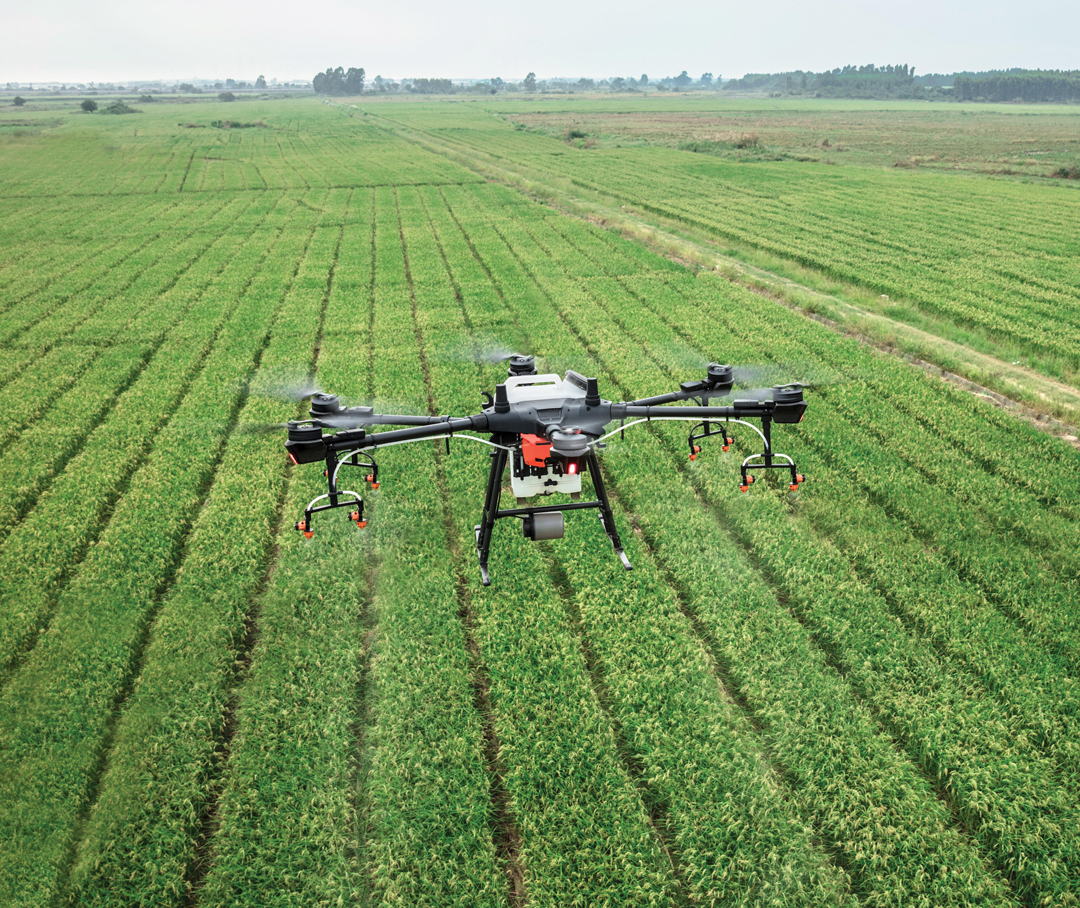
AFSC has taken its business to higher heights, about 120 metres to be exact. The insurance provider has just wrapped the second year of a drone imagery test program to better assess animal damage in crops and provide a more accurate picture of what happens in the middle of a field.
Once an image is captured, it’s automatically sent to a third party, which then utilizes a machine learning algorithm to assess damages. One of the primary goals of the project is to save time, money and be more exact with findings.
“Adjusters make estimations about what’s happening in the middle based on entry and exit points,” said Jesse Cole, supervisor of innovation at AFSC. “They’re pretty good at it, but it’s still an estimation. The drones and the algorithm kind of provide a potential solution that gets rid of any subjectivity.”
Once images are collated and seen by AFSC, adjusters can then speak with the farmer about a potential claim and discuss damages.
Most of the 10 farmers involved in the 2021 pilot year were based in the Peace Region where there is a large concentration of deer, moose, elk and other wildlife. The top five counties affected by wildlife damage are Saddle Hills, Athabasca, Birch Hills, Grande Prairie and Spirit River. The five-year average from 2016-2020 pegs non-waterfowl wildlife damage in Alberta is $13.3 million, affecting 67,000 acres annually. In 2019 alone wildlife damage in Alberta crops totalled $27 million.
Drones are now utilized by farmers for other purposes, such as aerial photography of land locations, decorative pictures as well as agronomic purposes such as identifying hot spots or wet spots in fields. They continue to grow in popularity and the greater the range of applications for agriculture, the better, said Cole. Though last year the project saw farmers gather their own drone imagery, Cole admitted this did not prove popular. The 2023 pilot session, conducted in the Spirit River and Fairview areas, allowed them to use their own drones, but time-strapped farmers generally prefer to have an AFSC contractor pilot the drones.
“Drones have been a tool we know exists but they’ve been looking for a job,” said Cole. “This project gives them a job. We need high-res images for beds and trails, you can’t get that from satellite imagery.”
Cole said they’ve determined that 120 metres (400 feet), also the maximum height legally allowed for drone flights, is suitable for the job. Depending on wind conditions, they have found it takes from 18 to 30 minutes to scope out a quarter section using a commonly available, easy-to-use quadcopter.
Everything went without hiccups in year one of the pilot, and the results of year two are under review. “It’s working well enough that there is promise here,” said Cole. Ultimately, if farmers and adjustors can save time with such automation of simple processes, it’s a win-win for everybody.
Though AFSC would like to offer drone assessment of wildlife damage across a greater portion of Alberta, for now, it will concentrate on the hardest hit areas of the Peace Country. It is possible AFSC will find additional uses for drones, such as for hail damage assessment, said Cole. “We have really got to make sure we’re approaching it in a pragmatic way where we’re going to solve a problem and we’re not just flying drones for the sake of doing so.”
Comments