


MAP QUEST
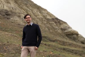
BY ZOLTAN VARADI • MAP DETAIL AND PHOTO COURTESY OF ALEX MCPHEE
Saskatchewan-based cartographer Alex McPhee makes western Canadian maps with a high level of detail and accuracy. Despite his growing reputation, potential customers occasionally try to spot omissions.
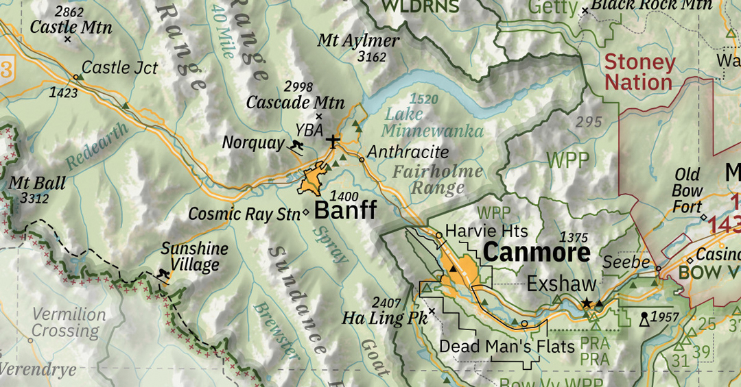
“At a trade show this year, pretty much every old guy who came up to my table was like, ‘Oh, every grain elevator, huh?’’ said McPhee with a laugh. They were skeptical of the accuracy of his Saskatchewan map, which features not just every elevator in the province but every grid road, Hutterite colony and treaty boundary.
Folks may try to catch McPhee coming up short on the details, but none have so far been able to spot an oversight. There’s good reason for this. McPhee spent more than 1,000 hours researching and drafting the 36 by 66-inch wall map, which sold 1,000 copies in its first month on the market. His 42 by 68-inch Alberta map is equally impressive. It features a complete inventory of abandoned railway stations, parks and public lands, First Nations’ traplines and provincial and public campgrounds.
McPhee began his map-making career while studying geophysics at the University of Alberta. Self-taught, he soon realized he was more interested in cartography than his degree courses. His tuition dollars were not wasted, however, as he soon found a customer base among his instructors. His first formal work was the creation of maps for scientific manuscripts. “Most professors hated making maps. It’s a specialized skillset,” he recalled.
Previous generations of western Canadian cartographers were more the explorer-surveyor type. These map-makers were engineers and surveyors trained to use etching and engraving tools and chemicals. “That all got thrown out in the ’90s,” said McPhee. “Cartography in general has not escaped the digital revolution; everything I do is digital.”
The tools of McPhee’s trade include readily accessible GIS mapping software that enables the user to analyze and map various sources of data. He also has access to every imaginable property or geographical datapoint through a variety of public databases. Over the past decade, the open data movement has pushed to make such information universally available. “This stuff used to be much more siloed and specialized,” he said. “Now it’s more freely available than it ever has been.”
Though McPhee largely conducts the map-making process on the computer, his followup research often entails an element of exploration. When he was publishing the Alberta map, for instance, he took time to systematically visit every county in the province to get a “picture of life in the region,” but also just for fun. “I’m a fan of giant Prairie sculptures. I have a lot of roadside attractions marked,” he said.
Considering he graduated university and began map-making full-time in 2020, McPhee’s business has covered a lot of ground. He has been approached by several Prairie municipalities to produce wayfinding materials for tourist attractions and this spring was tapped by Alberta media outlets to produce provincial election-related polling and voting breakdowns.
And, of course, McPhee has found a dedicated clientele among western Canadian farmers. “Frankly, I think I’ve done so well just because every farmhouse already has a map wall in it,” he said. “All I need to do is say, ‘this is the best map of the province you can buy,’ and they’re like, ‘Great, I already have the wall space for it.’”
To purchase McPhee’s provincial maps, visit awmcphee.ca.

Comments