


CLEAR FOR TAKEOFF
BY DANIEL STEFNER • PHOTO COURTESY OF OLDS COLLEGE
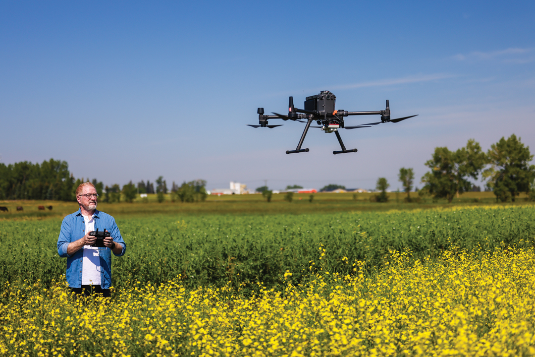
The use of drones has become commonplace in agriculture. The Olds College Centre for Innovation (OCCI)uses them in applied research activities. In the 2023 growing season, more than 10 such projects required drone flights to capture high resolution images and create datasets using cameras and sensors.
Though drones have historically been used to take pretty pictures of farmsteads and do the odd bit of in-season scouting, these incredibly beneficial research tools have many applications. To support plant, soil and water research they can be equipped with various sensors and cameras. These include standard red, green and blue (RGB) visual cameras that can aid in a wide array of analysis. Multispectral and thermal imaging as well as light detection and ranging (LiDAR) each provide intel that cannot be measured or differentiated using RGB.
OCCI drone projects delineate areas of hail damaged crop, calculate and analyze cereal lodging and lodging potential in plant growth regulator trials and complete remediation assessments of rehabilitated wellsites. When studying hail damaged crops, the RGB and multispectral imagery provide visual reference of the crop from above and the ability to review various vegetation indices specific to the crop type and respective growth stage. LiDAR is used to create a digital surface model of crop height. This indicates changes and differences in height that result from crop damage. Thermal imaging defines key differences within a field that cannot be detected by other sensor types. Crop canopy temperatures can vary a great deal from soil temperature. Discrepancies can be used to monitor crop stress and canopy coverage.
Multispectral sensors can be used to collect normalized difference vegetation index (NDVI), a plant health and density indicator. Data can be collected throughout the year, before and after product application, which enables researchers to detect and study how these factors change over a crop year. This change detection tool highlights increases and decreases in greenness. Such information is valuable for rotational grazing assessments, variable rate fungicide trials and even hail damage detection when pre-storm imagery is available.
High-resolution orthomosaic images are created by stitching together smaller individual images to create one large high-quality image. To generate an image of an entire field, for instance, the process requires a great deal of RAM.
While most RGB cameras are relatively inexpensive, these additional technologies can be expensive, but continued advancements are making them more affordable and available. Purchasing an expensive LiDAR sensor or multispectral camera for a single project may not be economical. Renting, leasing or sharing drones and associated sensor equipment is a great alternative.
Drone use at OCCI will see these machines integrated within a wide variety of projects.
One project will deploy drones in a swarm to collect field imagery. This would allow faster imagery collection and agronomic decision making. As drones themselves become more advanced, they may be used for targeted spray application.
In addition to supporting research activities, drones are integral to Olds College campus operations. They are used by students and faculty to map field boundaries, make equipment training videos, observe farm animals, track construction projects, perform building inspections and provide videos and imagery for marketing purposes.
For information about these projects and more, visit oldscollege.ca/smartfarm.
Daniel Stefner is a smart agriculture project lead and farm liaison with the Olds College Centre for Innovation.

Comments