


KEEPING ALBERTA MOVING
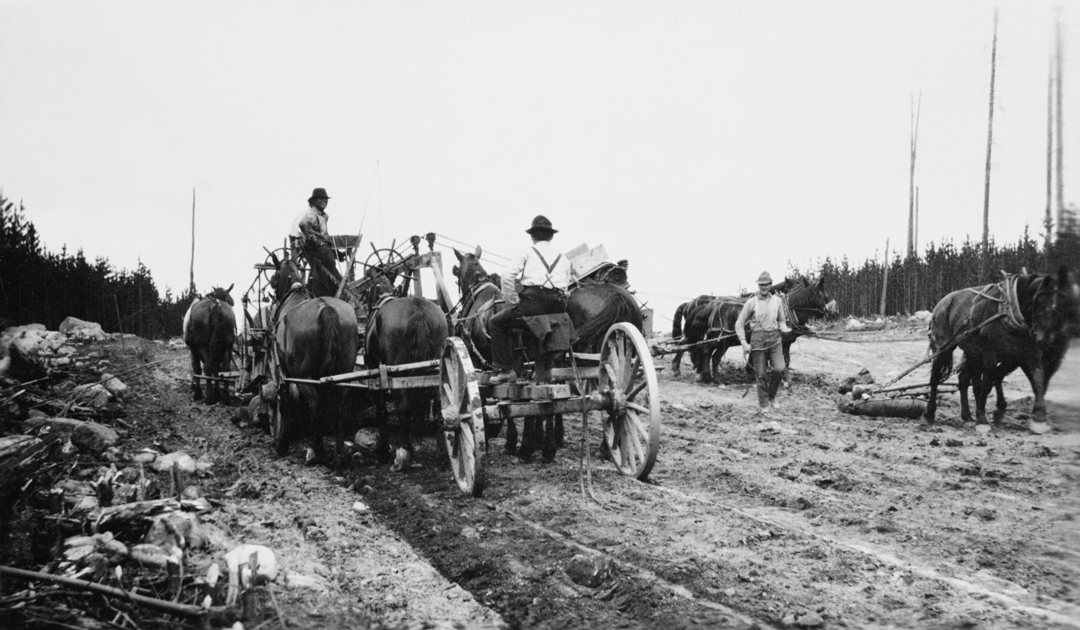
PHOTO COURTESY OF GLENBOW MUSEUM ARCHIVES
In the early 1900s, transportation was an important issue for residents of the settlement that would become Edson. About the time this road construction project was photographed in 1910, the Grand Trunk Pacific Railway was also built through the settlement on its way to the Port of Prince Rupert. When the community became a village and then a town in 1911 as a nod to the line’s value, it was named for railroad general manager Edson J. Chamberlin. The community’s roadways would have largely accommodated horse-drawn traffic as automobiles were a novelty at the time. When Alberta joined the Canadian dominion in 1905 there were a mere 40 automobiles in the new province and by 1911 the number had only modestly increased to 400.
Rail lines and roadways provided needed access to Alberta’s coal resources, and Edson served as a supply depot as the railroad pushed West. The community was also the jumping-off point for those who travelled the Edson to Grande Prairie Trail to homestead in the Grande Prairie Region.
Today, Alberta residents and industries rely on a vast network of roads and highways. According to Alberta Transportation statistics there are about 31,000 kilometres of designated highways and more than 226,000 km of public roads in the province. (Alberta has about 22 per cent of the national road network—second only to Saskatchewan). Of the total public road network, about 165,000 km are gravel, treated or earthen roadways largely falling under municipal jurisdiction.
It wasn’t until 1922 that the province agreed to share road-building costs with municipalities. Until then, it had often been carried out by automobile owners and car clubs. In contrast, the province’s 2018 five-year, $30-billion capital plan has earmarked $3.3 billion for road and bridge work.

Comments