


 23 / 52

Spring
2018
grainswest.com23
“The worst time for hail is mid-July to late August, when the
weather is really hot. It’s devastating when it happens,” Young
said, recalling one storm during the 1970s that took out his
entire crop.
Such devastation prompted the Alberta Severe Weather
Management Society to launch its Alberta Hail Suppression
Project in 1996. Program director Terry Krauss explained that
the society is mostly focused on urban areas, dissipating an
average of 31 storms per year. As part of this process, billions of
microscopic silver iodide particles are released from airplanes
into threatening storm clouds. The particles act as artificial
ice that freezes the already cooled water drops within the
storm’s updraft. As a result, billions of additional ice crystals
form, competing for excess cloud moisture. The result is the
production of ice particles that either melt completely or fall as
diminished hailstones. “Instead of large, damaging hailstones,
multiple small stones creating less damage are formed,”
explained meteorologist Kulak.
Looking ahead to the 2018 growing season, Prairie farmers
will certainly be monitoring moisture levels. In a January
edition of
The Western Producer
, agricultural meteorologist
Drew Lerner of World Weather Inc. in Kansas City predicted
the Canadian Prairies could see more early moisture this
spring due to an anticipated weakening of La Niña weather
phenomena that could also result in dry conditions in late
spring and early summer.
The U.S. National Weather Service Climate Prediction Center
also issued a statement saying La Niña crested in mid-January
and is expected to weaken going into spring. “Forecasters
believe this weak-to-moderate La Niña is currently peaking and
will eventually weaken into the spring,” the agency stated in a
January press release. It added that La Niña will create below-
average temperatures and above-median precipitation across
the centre of the continent.
La Niña is characterized by unusually cold water temperatures
in the Pacific Ocean near the equator. The opposite of La Niña
is El Niño, when ocean temperatures in the same area are
unusually warm. The two weather systems tend to impact North
American weather, including Alberta’s, by either creating cooler
winters with more snow (in the case of La Niña) or warmer
winters with less snow (when El Niño is present).
The variability of Alberta weather keeps farmers and
meteorological experts striving to find the best way to
work with this unpredictability. In addition to the province’s
innovative weather monitoring and compilation of historical
data, Young said he and his farming colleagues bring their own
unique element to weather prediction—their sixth sense. “We
move when the time is right. It’s like intuition. There’s a certain
point in time when you have to get it done.”
As far as facts go, weather-modelling and data-collection
technology is changing quickly, which means an increasing
number of resources are available to help farmers make
agronomic decisions. While these may not completely eliminate
uncertainty, they do strengthen the decision-making process.
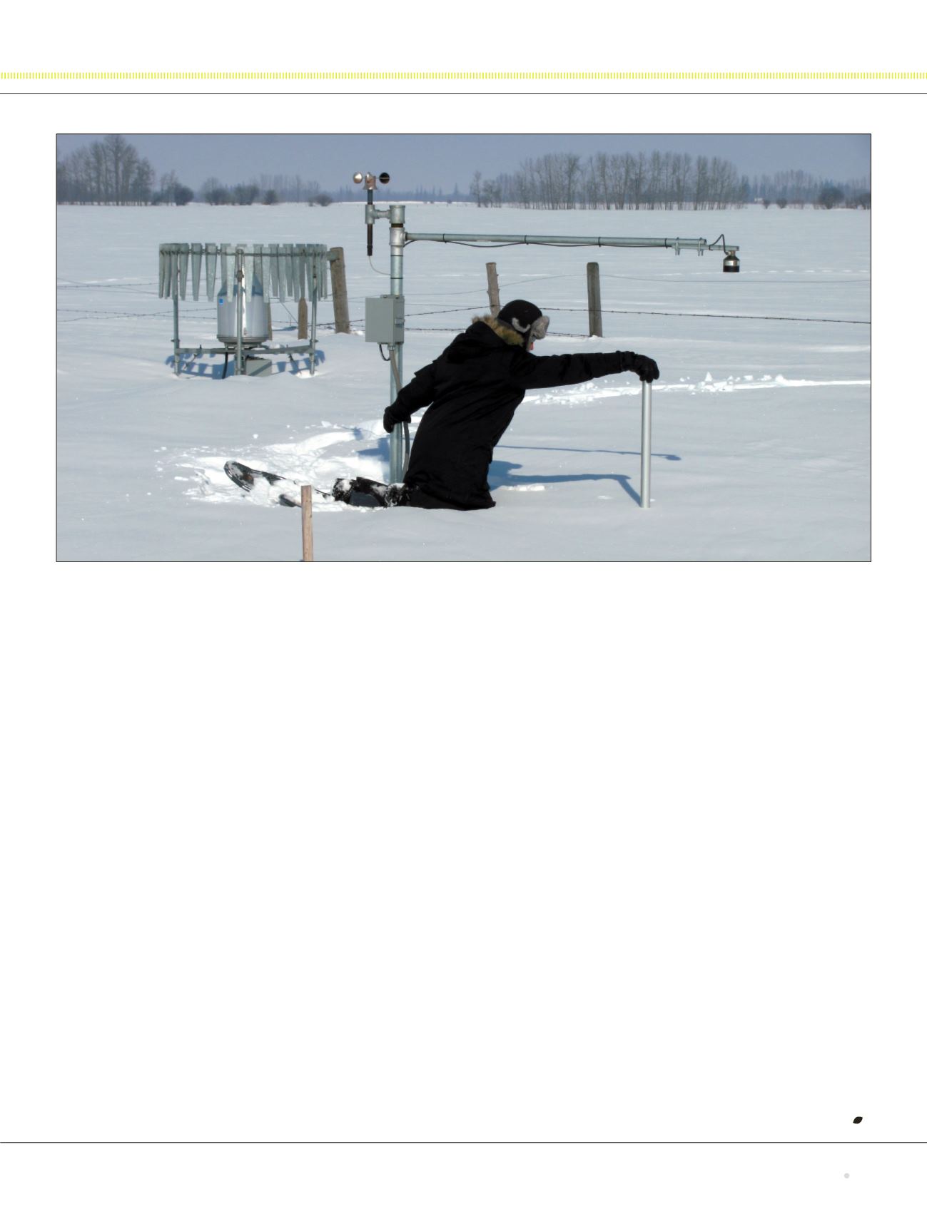
Using a manual snow sampler, Alberta Agriculture and Forestry meteorological technologist Tyler O’Reilly conducts a snow survey near the hamlet of Dapp. The pole at his left
hand is topped with a wind sensor, while the extended bar supports a snow-depth sensor. To his far left is an all-season precipitation gauge.