


 22 / 52

Spring
2018
Grains
West
22
taking an atmospheric picture every 10
minutes. These images are then used to
create animated weather maps.
ACIS has come a long way since its
inception. Wright noted that in years
past, volunteer weather monitors would
take their own measurements and send
the information to Environment Canada.
The recording of this information
would take several weeks, making
any immediate use of the information
impossible. “Hourly data with agriculture
is very important,” said Wright. “ACIS
brought the hourly weather observations
of more than 400 weather stations
province-wide, together.”
As ACIS has grown and evolved, so
have the needs of the agricultural users
of the weather data it produces. As
weather patterns change, the level and
spread of disease and insect pressures
likewise evolve.
The weather has a definite impact on
Fusarium head blight (FHB) treatment and
spread, Wright said. Infectious FHB spores
are spread by wind, blowing from one
cereal field to another, potentially resulting
in significant loss in yield and quality. The
effectiveness of fungicide is also impacted
by wind speed and humidity levels.
Last year, in collaboration with ACIS,
the Alberta Wheat Commission launched
the Fusarium Head Blight Risk Tool, a
mobile-friendly website available at
weatherdata.ca.By tracking disease
risk, the tool puts data in farmers’
hands that can help in making informed
management decisions. This includes
FHB severity values, precipitation levels,
air temperature and humidity levels. By
accessing ACIS FHB data, farmers are
able to examine precipitation levels on
their farms from as recently as 10 minutes
prior. Radar information provides views
of approaching storm clouds and rainfall
paths. Further development will see
the inclusion of other ag-pertinent data.
Information on swede midge and alfalfa
weevil will be added this year.
Wright suggested farmers visiting the
ACIS website (
agriculture.alberta.ca/acis) for the first time begin by finding
the closest weather station to their
farm. Look at weather data from the last
hour and check conditions from the
previous day. He said farmers may also
want to look at growing conditions from
last season and further back. Search
features include wind speeds, soil
moisture depth, growing degree days
and almanac details.
“You can zoom right to your area and
see precipitation from the last 10 minutes
and do radar forecasts,” Wright said.
“Farmers can look at storm clouds and
wonder, ‘Should I spray or plant? Where
are those clouds going?’ The information
on the website tells them the answer to
those questions.”
ACIS logs as many as 10,000 users
a month fromMay to September.
Usage spikes at planting, growing and
harvest phases of the season, as well as
whenever major weather events occur,
Wright explained.
He pointed out that everyone from
greenhouse operators to crop producers
can find value in this real-time weather
information. While greenhouse operators
can use the data to determine cloud
cover and track potentially damaging
windstorms, crop producers can check
wind speeds to decide whether or
not to spray, and those with irrigation
operations can use the data to guide
water usage. Naturally, every farmer is
interested in the occurrence of possibly
damaging hailstorms.
Such hail information is important to
farmers like Young, whose land is located
in Alberta’s Hailstorm Alley, which takes
in the area around Calgary in a strip that
runs north of Red Deer. Young suggested
he’s likely in one of the worst hail areas of
the province.
At over 1,000 metres above sea level,
the region’s high elevation sees cool
air from the upper atmosphere remain
closer to the ground than in lower-lying
areas. Hailstorms form when moisture-
laden air from the Pacific Ocean travels
east over the Rocky Mountains. This
cool, dense and wet air drops to
ground level, displacing warm summer
air and creating a weather spin cycle
that pushes water droplets to higher
altitudes where they freeze. They
fall and are again pushed higher by
updrafts, forming into hail pellets.
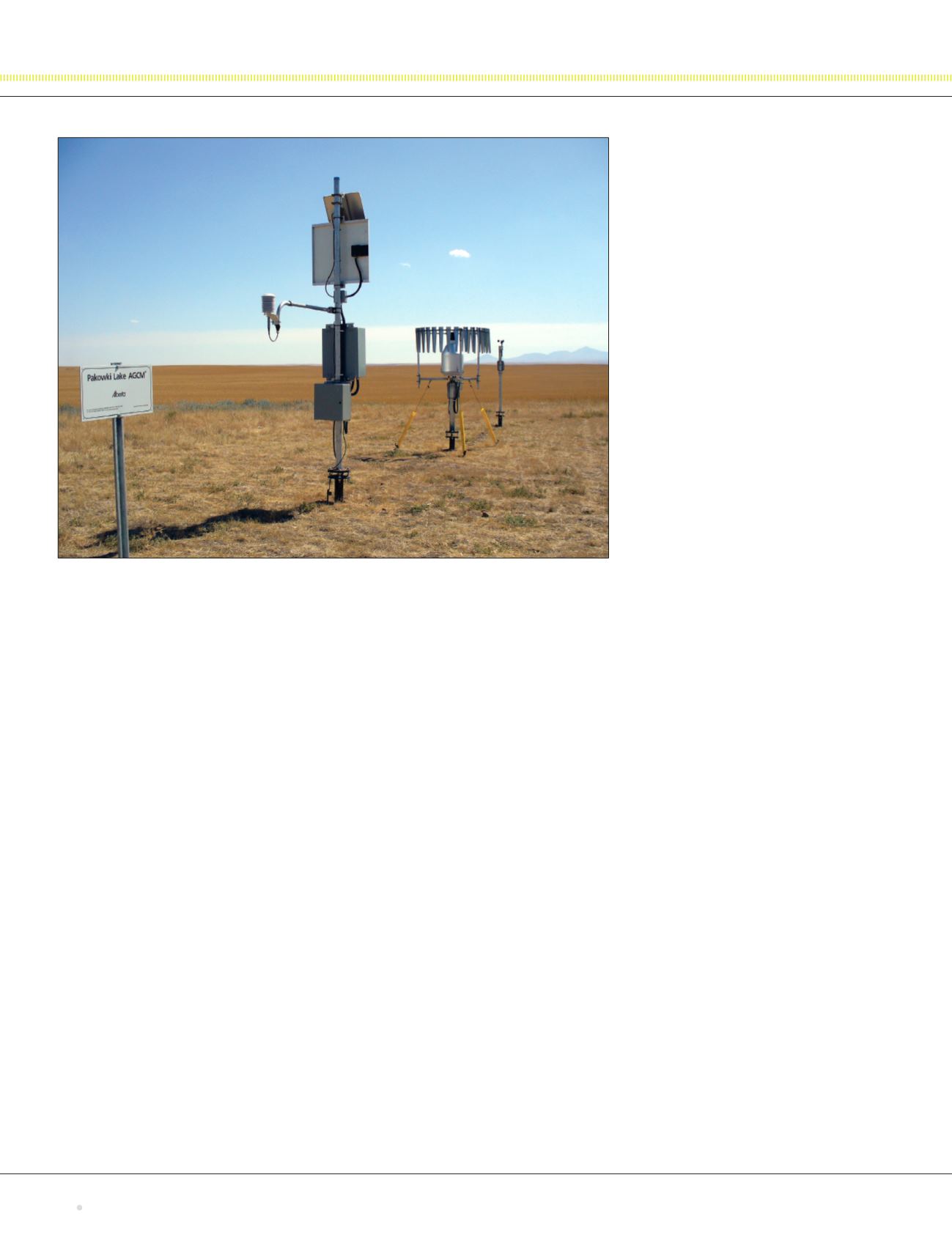
One of 400 Alberta Agriculture and Forestry weather stations, this solar-powered equipment captures and
transmits relative humidity, temperature, precipitation (rain and snow) and wind speed on an hourly basis.