


 18 / 52


GW
: Do these standard weather stations
provide foolproof data?
DI:
Sometimes the sensors can fail or
report faulty readings, so the computer
system uses a quality-control program to
identify errors and replace faulty data. We
audit each error correction.
GW:
How is that data used in the
modelling?
DI:
The drought risk management and
weather analysis is the first part. We
need to know where it is dry, what is the
extent of the drought, its severity. It’s not
enough that we measure—we also need
to know historically where it stands. I
can’t just report that recently the tem-
perature was cold; it doesn’t make sense
until you compare it historically. We
went through the historical weather data
going back through the last 100 years
and we put together a good weather data
set that was collected by Environment
Canada and others, we organized it, and
now anytime we have data, we can com-
pare it going back to 1961. We are unique
in that.
GW:
What else separates Alberta’s
weather analysis from that of other
Canadian and North American regions?
DI:
From my work experience, Alberta
has one of the biggest standard weather
station networks. From the 47 stations we
started with, we now have 174 weather
stations across Alberta. This is thanks to
work with other groups including crop
insurers. When I started working on this,
crop insurers sold plans based in part on
precipitation, so they either had to find
a network to use or put in the time and
money to build their new networks. We
convinced them the best option was to ex-
pand the existing drought-station network
to have reliable data, and we would take
responsibility for the data. That started
in 2007, and in that first year we added
67 weather stations. That is impressive.
We also make use of all other provincial
near-real-time weather station data, do
quality control on their data and report it
to the public.
GW:
How available is the weather and
drought data to the average person?
DI:
This information is freely available
online at the Alberta Climate Information
Service (ACIS) website—for updates from
our stations to province-wide weather
conditions.
We also regularly report and map pro-
vincial drought and moisture conditions
year round, including weather analysis,
and publish it on ACIS. Our regular
map summarizes the past seven and 15
days, plus monthly, growing-season and
cold-season conditions. As part of the
provincial crop report, we provide
growing-season moisture condition
updates every week so farmers know
how conditions are. Our models and risk
assessment tools are publicly available on
our website
(weatherdata.ca).
GW:
Are there other applications for
this data besides drought monitoring?
DI:
There is another agricultural risk
program I’m a part of. We are develop-
ing models that predict insect pest risks
across the province. The objective is
to provide insect risk forewarning and
decision-making support for effective pest
management.
In 2013, we implemented a daily
grassfire danger forecasting model that
produces two maps showing fire potential
and fire-spread conditions for the agricul-
tural area of the province.
GW:
What ambitions do you have for
the program?
DI:
I would like to continue expanding
our weather data use and modelling ex-
perience to serve provincial, agricultural
and environmental risk management
programs. I also would like to expand
the success of our weather monitoring
network and use of the data to support
agricultural and environmental risk
management tools in other provinces and
around the world, including Ethiopia and
East Africa. We’ve been lucky to get the
funding we have, and it would be nice to
share the experience we’ve had.
Spring
2018
Grains
West
18
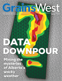
Amember of Alberta Agriculture and Forestry’s AgMet unit, Daniel Itenfisu said the province has one of the biggest
standard weather station networks in the world.