


 21 / 52


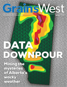
Spring
2018
grainswest.com21
HE FORTUNES OF ALBERTA FARMERS ARE
perennially subject to the wild whims of the
weather. The province’s uniquely variable
meteorological movements have forced climate
scientists to continually beef up their data-gathering,
information-interpretation and prediction powers. While
actively changing the weather is possible in localized
measure, experts focus their energy on upgrading
forecasting technologies and updating weather models
that will give farmers the best information with which to
make agronomic decisions.
Dan Kulak, an Edmonton-based meteorologist with
Environment Canada, said the Rocky Mountains are
largely to blame for the unpredictability of Alberta’s
weather. “The mountains rip those weather systems apart
and they re-form near Red Deer in a long north-south
corridor.”
As winter turns to spring, the re-forming of these
weather systems, combined with still-cool air
temperatures, can often result in springtime rain turning
to snowfall. “You want to have April showers bring May
flowers, but often in Alberta it’s May snow,” Kulak added.
The accumulation of snow combined with subsequent
rainfall can create flood conditions, Kulak said. He also
noted the foothills receive high precipitation levels and,
depending on which river the rain and snowmelt flows
into, flooding can occur.
Terry Young grows wheat, barley, faba beans and
canola near Penhold. “Variableness is the key to weather
in Alberta,” he said. Young pointed to Environment
Canada’s weather updates. Delivered throughout the
day, he noted each can be completely different. “Every
forecast is changed from the last. You get up in the
morning and you think you’re going to go cut some hay,
and then the next forecast, it’s completely changed,”
Young said.
For Ralph Wright, manager of Alberta Agriculture and
Forestry’s Alberta Climate Information Service (ACIS),
an online interactive weather tool that features historical
and real-time meteorological data, looking at historical
weather data is just as important as the current weather
forecast, if not more so. Wright also said real-time
weather can be critically important in aiding decision-
making in the field.
“I imagine that every day every farmer wakes up and
wonders, ‘What’s the weather going to be like?’ What they
are missing is what was the weather like? Did it rain last
night? How long has it been since it rained on my corn field
that’s down the road that I haven’t visited for a week?”
Knowing such weather information for a specific field
can help guide decisions depending on the time of year,
helping farmers choose whether to spray or wait, irrigate
or not, harvest or hold off, Wright said.
ACIS information can also be used in concert with
analytics on yields, he noted. At the end of the growing
season, farmers can use collected data to determine the
effects of weather on individual fields. Combined with
management records, the historical weather data can be a
powerful farmmanagement tool.
The collection of meteorological information at ACIS
generates a long-term view of weather trends in specific
areas, Wright said. With 12,000 maps of Alberta weather
and climate-related information as part of the ACIS
information trove, he said his job is to continue collecting
data over the “long, long, long term” in order to develop
quality historical weather data.
“Do not take the last months of weather to try to predict
the next month of weather, because it just doesn’t happen
that way anymore,” Wright said. Weather data extending
back to the early 1960s can now be used to track trends
and improve the accuracy of predictions.
Wright said ACIS emerged in 2002, the same year the
Prairies experienced one of the biggest droughts in years.
Albertans were left without detailed historical weather
data or current information on weather conditions in
specific areas around the province, so the drought—while
devastating for crops—helped solidify the need for ACIS,
he said.
Since then, ACIS has strengthened its network
of weather stations to 400-plus, all measuring air
temperature, wind speed and precipitation levels.
Around 40 of the stations also record soil moisture and
soil temperature data, and approximately 80 measure
solar radiation. All capture radar imagery,
T