


ORBITAL AGRONOMICS
BY GEOFF GEDDES • PHOTOS COURTESY OF AGRICULTURE AND AGRI-FOOD CANADA
With the launch of the RADARSAT Constellation Mission (RCM) by the Canadian Space Agency (CSA), a world of new and improved data will be available to the agricultural sector.
The RCM includes three identical Earth observation satellites sent into orbit on June 12, 2019. “Canada launched its RADARSAT-1 mission in 1995,” said Heather McNairn, a federal research scientist at the Agriculture and Agri-Food Canada (AAFC) Ottawa Research and Development Centre. “It was used primarily for monitoring ice flow to aid ship navigation. RADARSAT-2 in 2007 expanded the scope to include land-based monitoring such as forestry, wetlands and flood activity.”
Whereas the first two launches were large, single satellites, the RCM includes three smaller satellites. This approach is a response to the huge demand for marine and land data. “With three satellites we can gather more data and do it three times as frequently,” said McNairn. “This is important for tracking things that may change rapidly like soil moisture and flooding.”
TUNED TO THE RIGHT FREQUENCY
The higher frequency of imaging offered by the RCM could be of significant benefit to farmers. “From an agronomy standpoint, if we can pinpoint soil moisture more precisely in the spring, we may be able to make better yield estimations, as yield is driven by moisture,” said JP Pettyjohn, crop technology instructor at Lakeland College in Vermilion. “Armed with estimates, we can set our fertilizer levels to maximize efficiency.”
In addition to the greater image quantity, there is a quality aspect to the RCM that distinguishes it from many of its orbital peers. “Compared to the optical data provided by a lot of satellites, the biggest advantage of radar data coming from the RCM is that it’s not affected by weather conditions and can see through clouds,” said Aaron Berg, professor and Canada research chair, department of Geography, Environment and Geomatics at the University of Guelph. “That’s critical in Canada, as we can now get regular, high-resolution updates on vegetation and crop health, crop phenology and seeding conditions.”
A MAP FOR SUCCESS
The maps generated from satellite data will eventually aid farmers with agricultural decision making as the information is fed into precision ag systems and employed by agronomists and researchers.
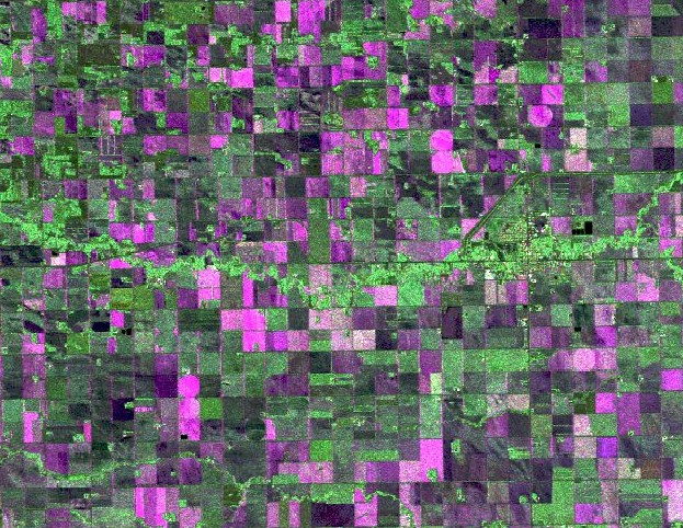
The AAFC annual crop inventory maps, which classify crops grown in every field across Canada, are currently produced from RADARSAT-2 and other satellite data. These maps are publicly available for free through the Government of Canada open data portal. Now that the RCM has been launched, the Agro-Climate, Geomatics and Earth Observation (ACGEO) division of AAFC plans to use its radar data to enhance the maps.
“There are two important characteristics of RCM that will help the crop inventory maps,” said McNairn. “With three satellites, we expect to get more images during the growing season. Secondly, there is an advanced mode on RCM called compact polarimetry or CP. With this mode, more information about the target—which in this case is crops—can be gathered. It’s a bit like looking at a black and white picture versus that same picture in colour or infrared. With more data and this CP mode, we expect that the accuracy of the maps will increase, and that some crops that may have been more difficult to identify could be pinpointed more easily.”
As well, while the government’s optical satellites now deliver weekly crop-condition maps, AAFC is developing methods to upgrade this information based on RCM’s cloud-free imagery and more frequent data collection.
With the growing focus on precision agriculture, the RCM launch is a timely one, largely for its contribution to data layering. Much of precision agriculture is about using all areas of the field as efficiently as possible, which helps to maximize profits while minimizing environmental damage.
“RCM data will shed light on which areas of the farm are performing well under certain inputs, and which spots are underperforming and could be augmented or abandoned to reduce unwarranted expenses,” said Berg. “Any remote sensing tool with a high enough spatial resolution to get you that information quickly and support decision-making is one I would consider part of precision agriculture.”

Research scientist Heather McNairn (third from left) and Agriculture and Agri-Food Canada colleagues are pictured here with one of three RADARSAT satellites launched in June.
ONWARD AND UPWARD
While the current capabilities of RCM are intriguing, there may be more excitement on the horizon. “This is still in the research phase, but we just finished a project looking at integrating data from RADARSAT satellites and RCM to assess the level of disease risk for crops,” said McNairn. “We focused on diseases where the risk is elevated by wet soils that stay wet for an extended period. One of our main subjects was sclerotinia in canola, as it’s a pathogen that requires wet conditions to survive.”
Because sclerotinia feeds on the petals of canola, plant growth stage is also a key risk factor. McNairn collaborated in industry-led research to develop a methodology to identify growth stage from radar satellite images. In another example of data layering, the team then developed a web tool that could integrate information on soil conditions, cropping history and growth stage to generate a risk level for sclerotinia.
“This is a prototype rather than a live web tool, but it’s an illustration of how satellite data can aid producers,” said McNairn. “If soil conditions look risky and your canola is about to flower, you’ll know to visit that area. We developed these methods using satellites available today from Canada, Germany and the United States. With RCM … the plan is to transition these operations and research activities to the new satellites.”
For farmers wanting to capitalize on remote sensing and wondering if satellites or drones are the best option, it depends. “The effectiveness of a drone stems in part from the particular sensor it’s carrying,” said Berg. “Many sensors available for drones can be used for very high-resolution mapping, but height restrictions can limit the area mapped. Whereas a satellite can map hundreds of fields in one pass, you would require numerous drones and hours of flying time to do the same. On the other hand, drones can map at 10 centimetres resolution versus 10 metres or more for satellites. Therefore, you may get information on potential yield loss at the lower resolution derived from satellites, but you won’t know why it’s happening. Ultimately, the approach depends on your situation and priorities.”
RCM is a welcome addition for farmers and McNairn sees RCM as something to celebrate. “A lot of Canadians don’t realize that as a collective, our governments, academia and aerospace industry are leaders in radar technology, and have been for decades,” she said. “We produce top-notch satellites, and our engineering is world-class. Many countries are using satellites, but especially in terms of agricultural applications, our radar satellites are special. Their ability to see through clouds makes them unique from an operational perspective, and their sensitivity to water, soil and plant structure is exceptional. The launch of RCM should make all Canadians proud of our entire aerospace community.”


Comments